STORM-Net: Severe and Tornado Real-Time Monitoring Network
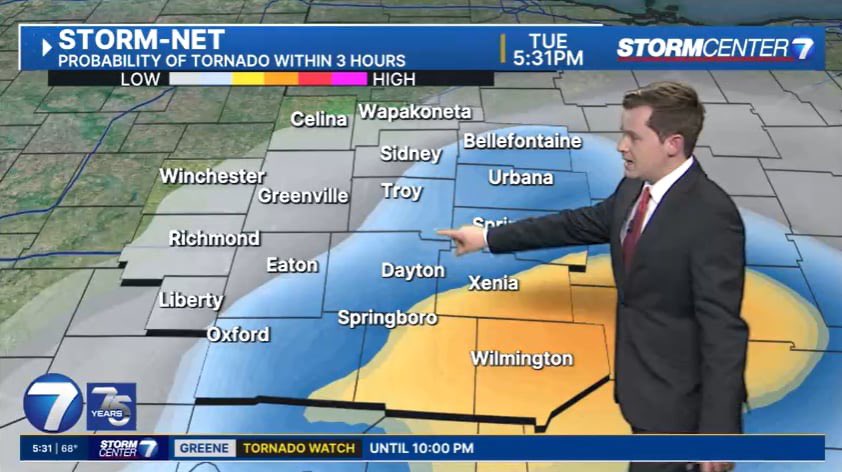
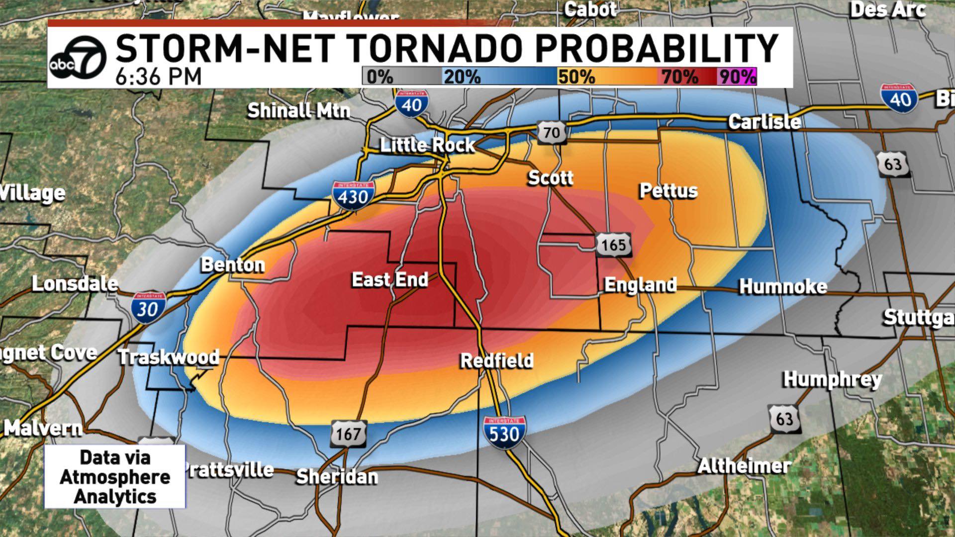
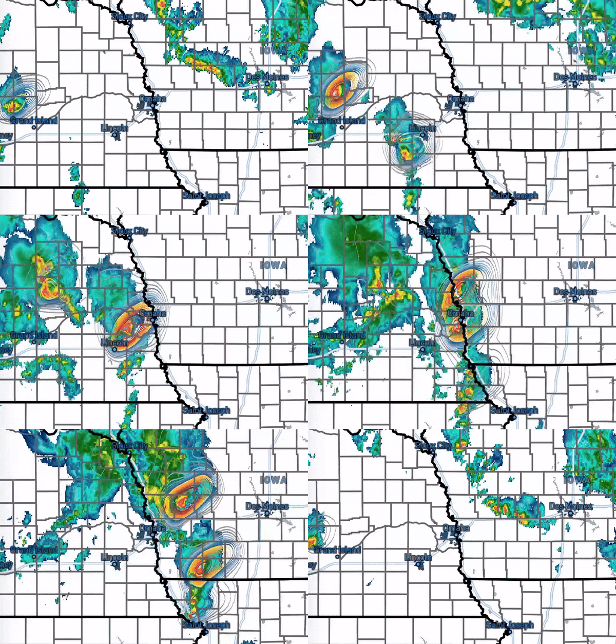
AtmoSphere Analytics proudly presents STORM-Net, a state-of-the-art deep learning model designed to revolutionize severe weather forecasting. Our innovative tool is the culmination of advanced meteorological research and cutting-edge AI technology, tailored to provide unparalleled real-time predictions of severe weather events.
Unmatched Precision and Timeliness
STORM-Net operates continuously, updating every 10 minutes to deliver the most current weather predictions. Covering the entire eastern half of the United States, our model ensures comprehensive monitoring and analysis of severe weather conditions, including tornadoes, damaging winds, hail, and flash flooding.
Cutting-Edge Deep Learning
At the core of STORM-Net is a robust deep learning framework that integrates real-time public and private meteorological data. This integration enables STORM-Net to accurately predict the likelihood, intensity, and duration of severe weather events with an accuracy unmatched in the industry.
Key Features and Benefits:
Real-Time Updates: STORM-Net's updates every 2 minutes provide the most current and relevant weather predictions, crucial for timely decision-making and emergency response.
Comprehensive Coverage: Our model spans the entire eastern U.S., ensuring no severe weather event goes unnoticed.
Advanced Prediction Capabilities: Predict tornadoes, hail, damaging winds, and flash flooding with unprecedented precision.
Multiple Datatypes: Seamlessly overlay STORM-Net predictions onto radar imagery for easy interpretation and application. GRIB2, HDF5, CSV, and NetCDF formatting is available upon request.
Valuable for Various Stakeholders: Whether you're a local TV station, national weather network, or an emergency management agency, STORM-Net is your go-to solution for real-time severe weather forecasting.
Ideal for Multiple Applications:
Media and Broadcasting: Equip your weather broadcasting with the most advanced prediction tool to keep your audience informed and safe.
Emergency Management: Enhance your preparedness and response strategies with accurate and timely weather predictions.
Public Safety: Aid in public safety initiatives by providing communities with advanced warnings of severe weather events.
Experience the Future of Weather Forecasting
STORM-Net is not just a forecasting tool; it's a vital asset in mitigating the impacts of severe weather. Our commitment to innovation and accuracy makes STORM-Net an indispensable tool for all who need reliable weather predictions.
Join us in our mission to advance severe weather forecasting. With STORM-Net, you're not just predicting the weather; you're preparing for the future.
STORM-Net Thresholds
The following is a general guideline to follow for STORM-Net probabilities. The technical definition of the STORM-Net probability is "percentage chance of (hazard) within 10 miles at this grid-point within the next hour". Here are some thresholds/general qualitative guidelines based on our testing:
These guidelines use "tornado", but apply to the wind and hail models as well.
0%-10% (grey): Tornado is unlikely over the next hour at this location.
10%-20% (darker grey): Tornado is unlikely over the next hour, but there is a storm that may start to display signs of a tornado. Stay weather-aware over the next hour.
20%-50% (blue): Tornado is possible over the next hour, though it is still unlikely. Pay close attention to NWS alerts and future runs of STORM-Net for updated information.
50%-75% (yellow to orange): A tornado is likely to occur during the next hour, or a tornado is currently in progress and moving towards this location. Seek NWS guidance and heed any warnings issued.
75%-90% (red): A tornado is likely ongoing, or is very likely to occur during the next hour close to this location. Seek NWS guidance and heed any warnings issued.
90%-100% (pink): A tornado is very likely ongoing and moving towards this location. Seek NWS guidance and heed any warnings issued.
SIG-Threat (lime green dotted outline): A significant tornado (ef2+) is possible over the next hour near this location, or is ongoing and moving towards this location. Seek NWS guidance and heed any warnings issued.
Frequently Asked Questions
- How does STORM-Net work? STORM-Net is a deep-learning application that takes various atmospheric data including mesoscale analysis data, radar data, observational data, and land-surface data across the entire grid, and uses all of that information to predict severe weather hazards across the grid. STORM-Net considers large-scale and small-scale patterns, as well as connections between the two, that may lead to the development of hazardous weather. STORM-Net outputs probabilities for tornadoes, significant tornadoes (ef2+), large hail (1"+), significant hail (2"+), damaging wind, and significant wind (65kt+).
- What data does STORM-Net use? STORM-Net uses a combination of observations, mesoanalysis, and radar-derived data. These come from a combination of private and public organizations.
- How often does STORM-Net run? STORM-Net runs every 2 minutes. The data is typically around 5-10 minutes behind the initialization time. This is due to the time that it takes for the data to pre-process, for the model to run, and for the data to be post-processed.
- Is STORM-Net a replacement for NWS advisories/watches/warnings/discussions? No! STORM-Net is a guidance tool to be used in conjunction with NWS guidance. It is not a replacement for NWS messages. It is not in competition with NWS messages.
Evaluation Metrics
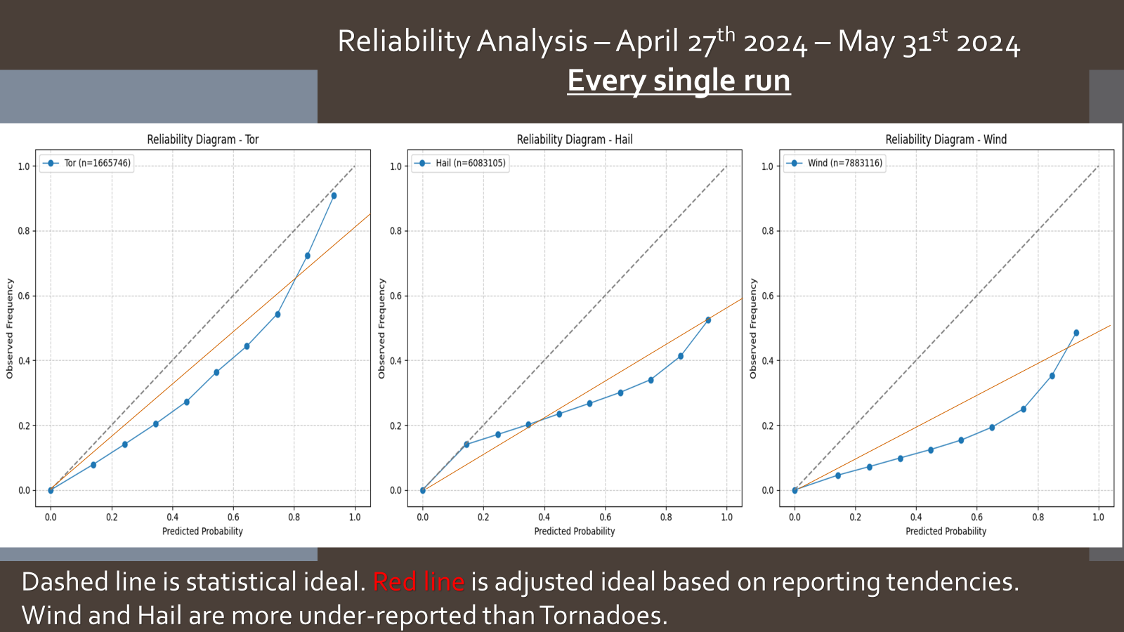
STORM-Net has been evaluated on 27 test cases, which consists of a total of 29.3 million total grid-points/probability values. These were chosen randomly and include a diverse set of meteorological events: various affected regions, various convective modes, and various seasons. The model has not seen these events in training, as they are used as a separate "test" set.
NWS Scores are included as a baseline/comparison benchmark. STORM-Net is not a replacement for NWS guidance.
PR-AUC (45min lead-time): v0.5- 0.464 | NWS Tornado Warnings- 0.365
STORM-Net Case Studies
Mayfield, KY | Violent and Deadly EF-4 Tornado on December 10th, 2021
Late in the evening on December 10th, 2021, the town of Mayfield, Kentucky was devastated by a violent EF-4 tornado. Dozens were killed and hundreds were injured.
The first tornado warning for Mayfield, KY was issued at 03:06 UTC. The first tornado 'emergency' was issued at 03:27.
The tornado hit at 03:30.
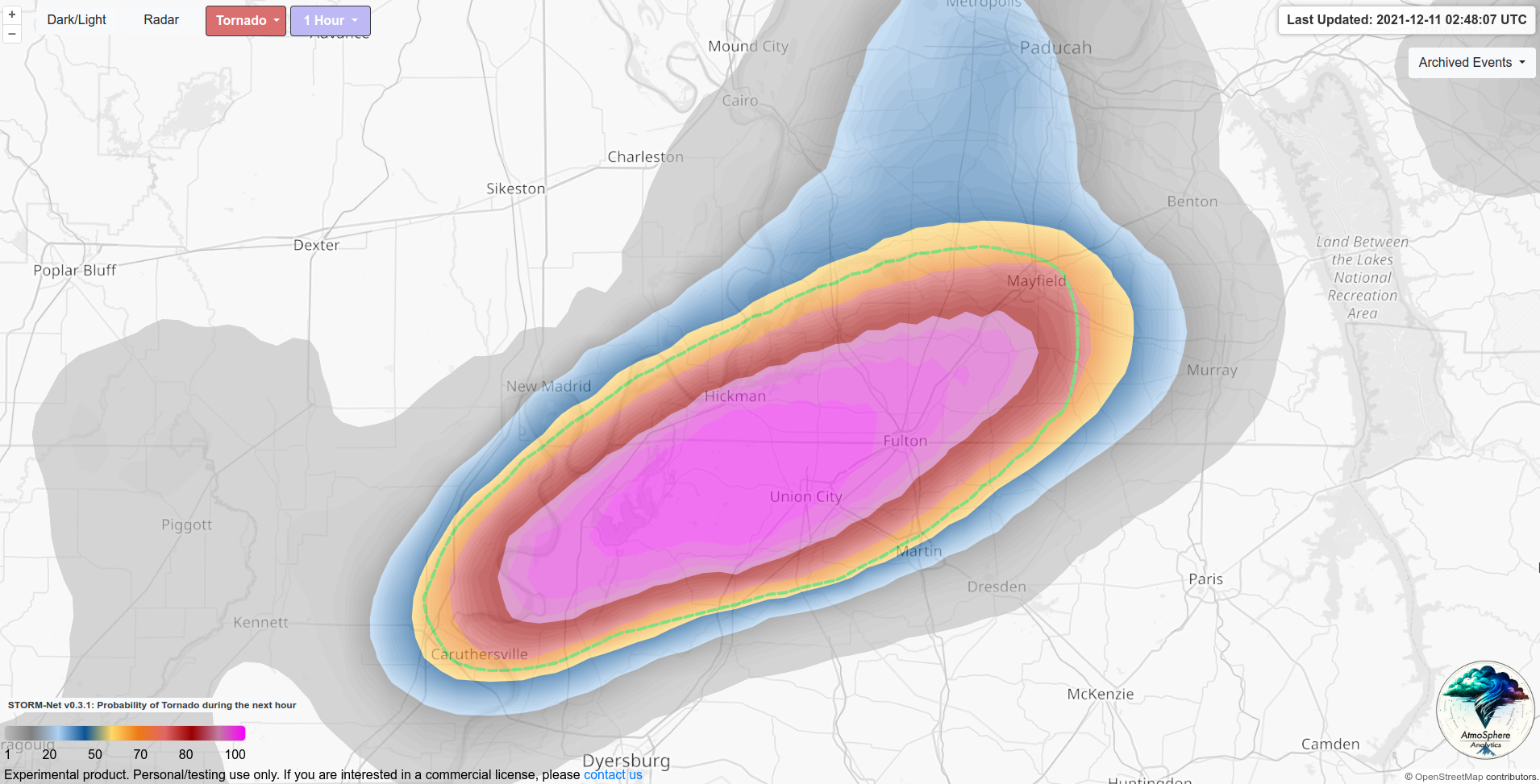
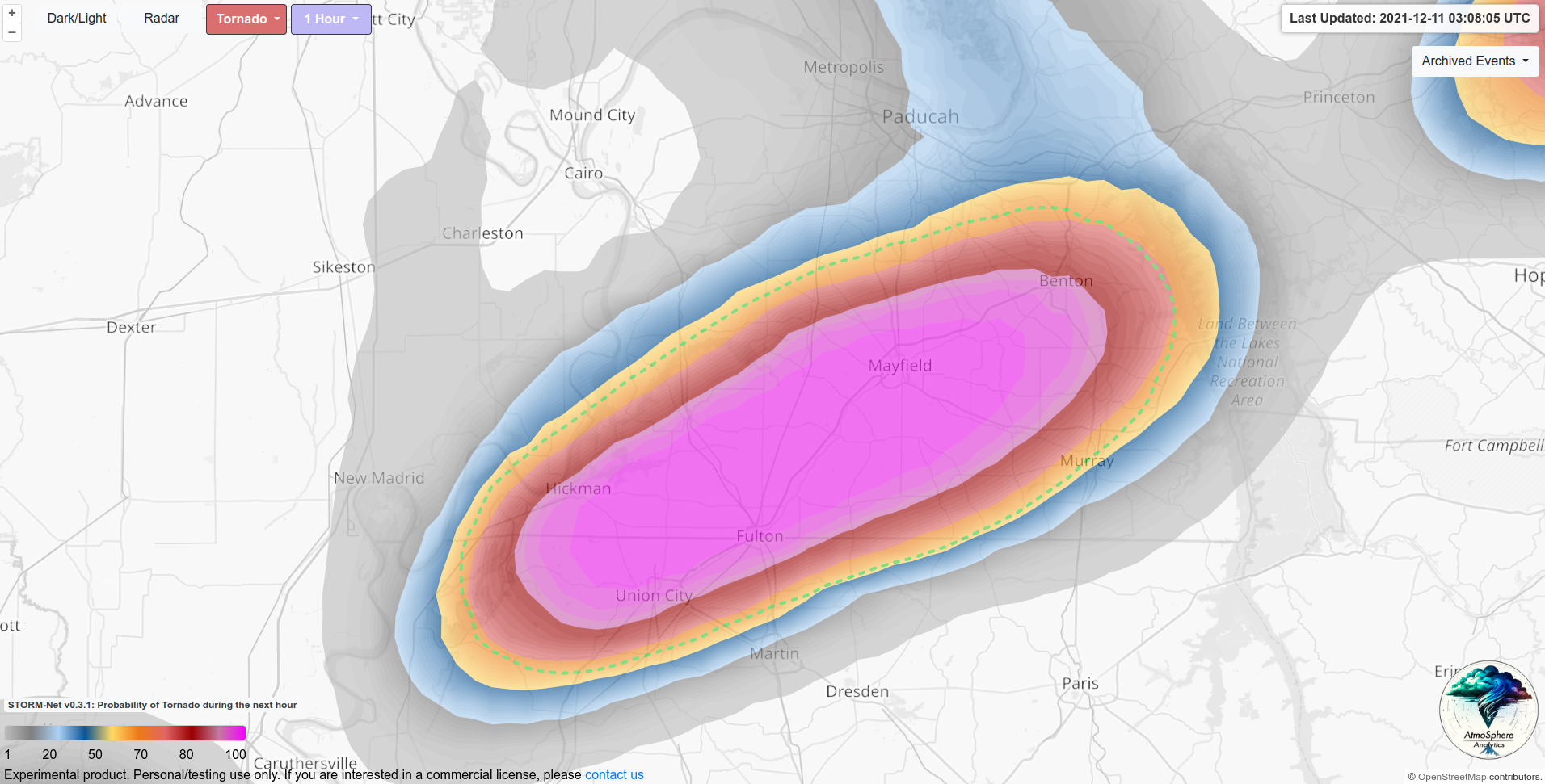
STORM-Net was highlighting the tornado threat for Mayfield 42 minutes prior to impact, with 75%+ probabilities at the 02:48 forecast, and even higher probabilities at 03:08. The Mayfield area was even included in a "significant tornado" zone denoted by STORM-Net, represented by the green outline.
Rolling Fork, MS | Violent and Deadly EF-4 Tornado on March 24th, 2023
Late on the night of March 24th, 2023; a tornado touched down and devastated a rural town of Rolling Fork, Mississippi. This tornado, being the first of the day, touched down after dark, with little warning, and had rapid intensification. It also plowed directly through a low-income rural community. All of these factors made this a recipe for catastrophe.
The first tornado warning for the supercell that affected Rolling Fork came at 00:46 UTC. The first tornado warning that actually included Rolling Fork was issued at 00:54UTC. The first tornado emergency was issued at 01:05. Rolling Fork was impacted by this deadly yotnado at 01:08.
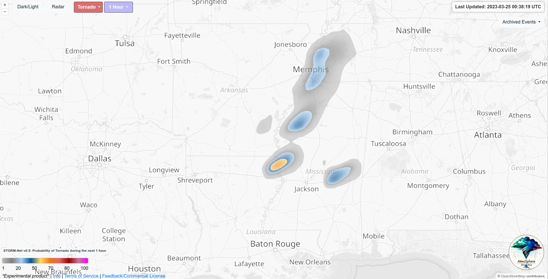
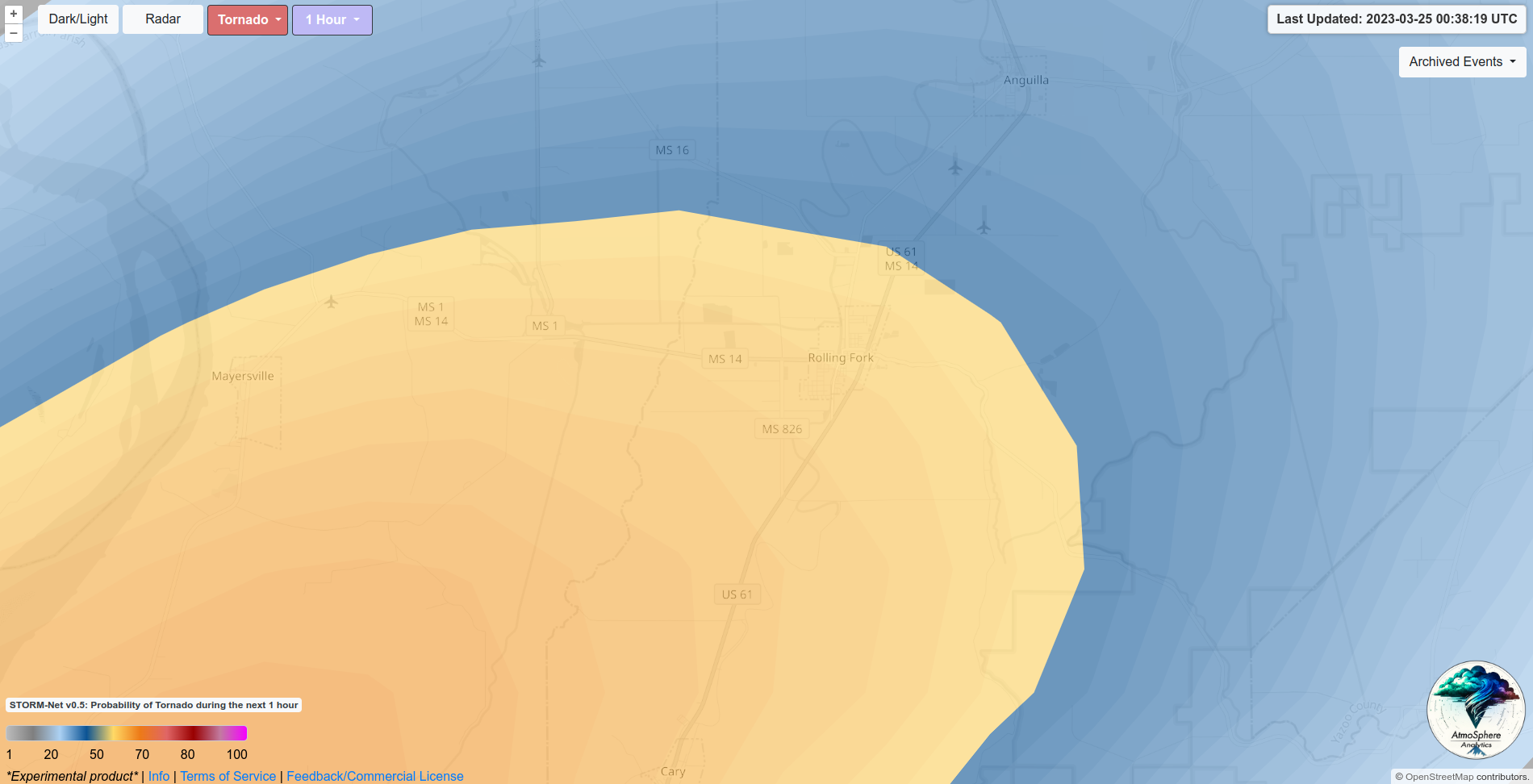
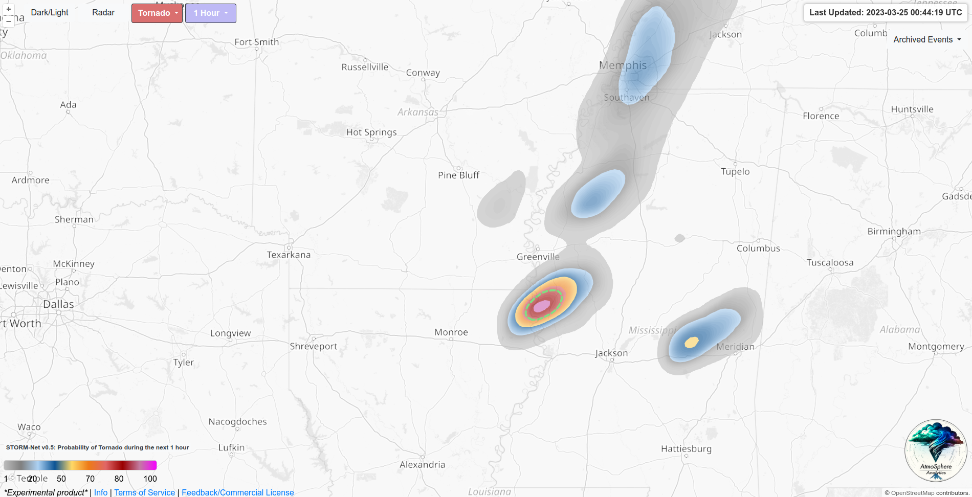
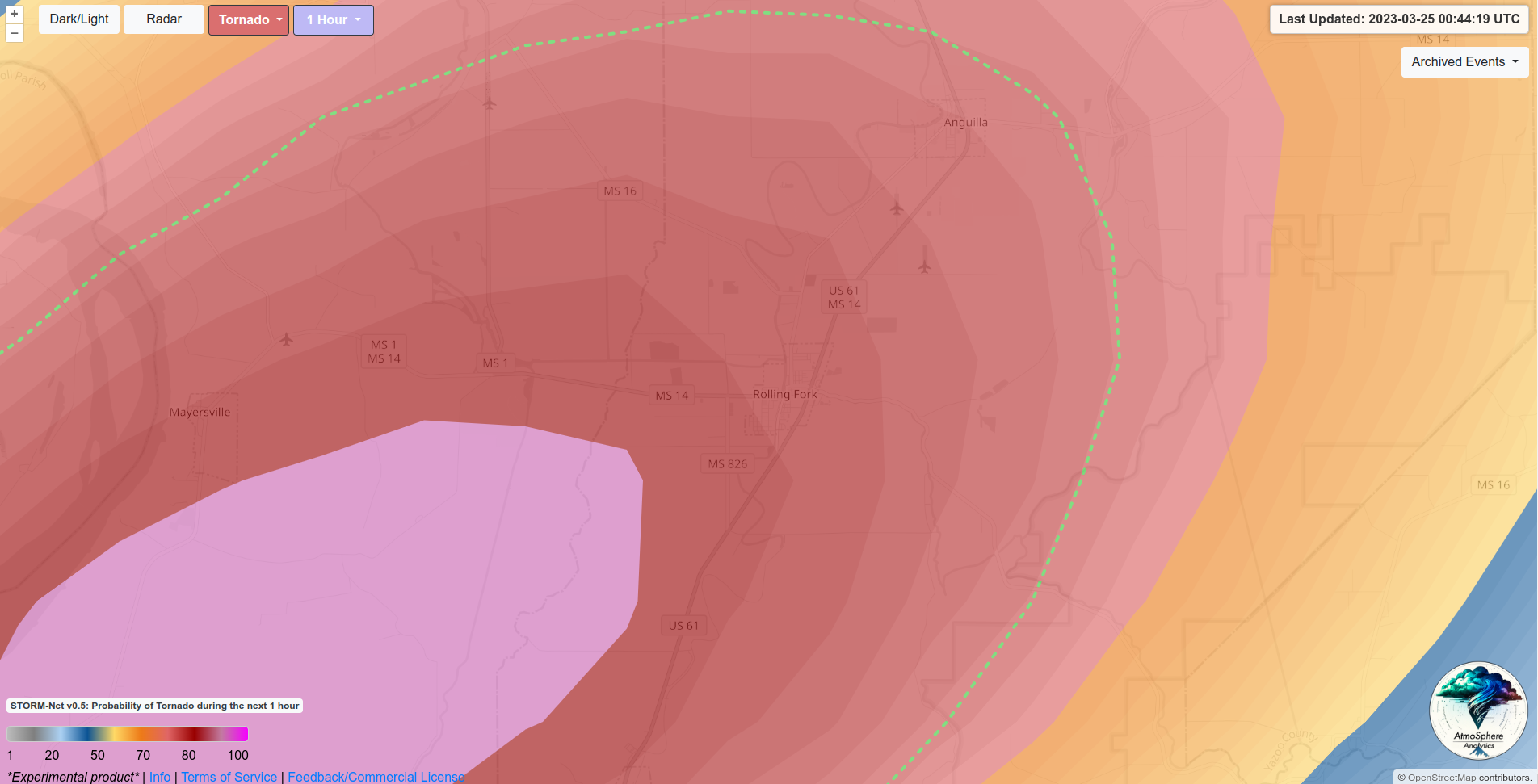
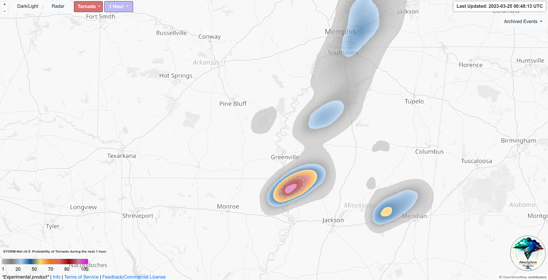
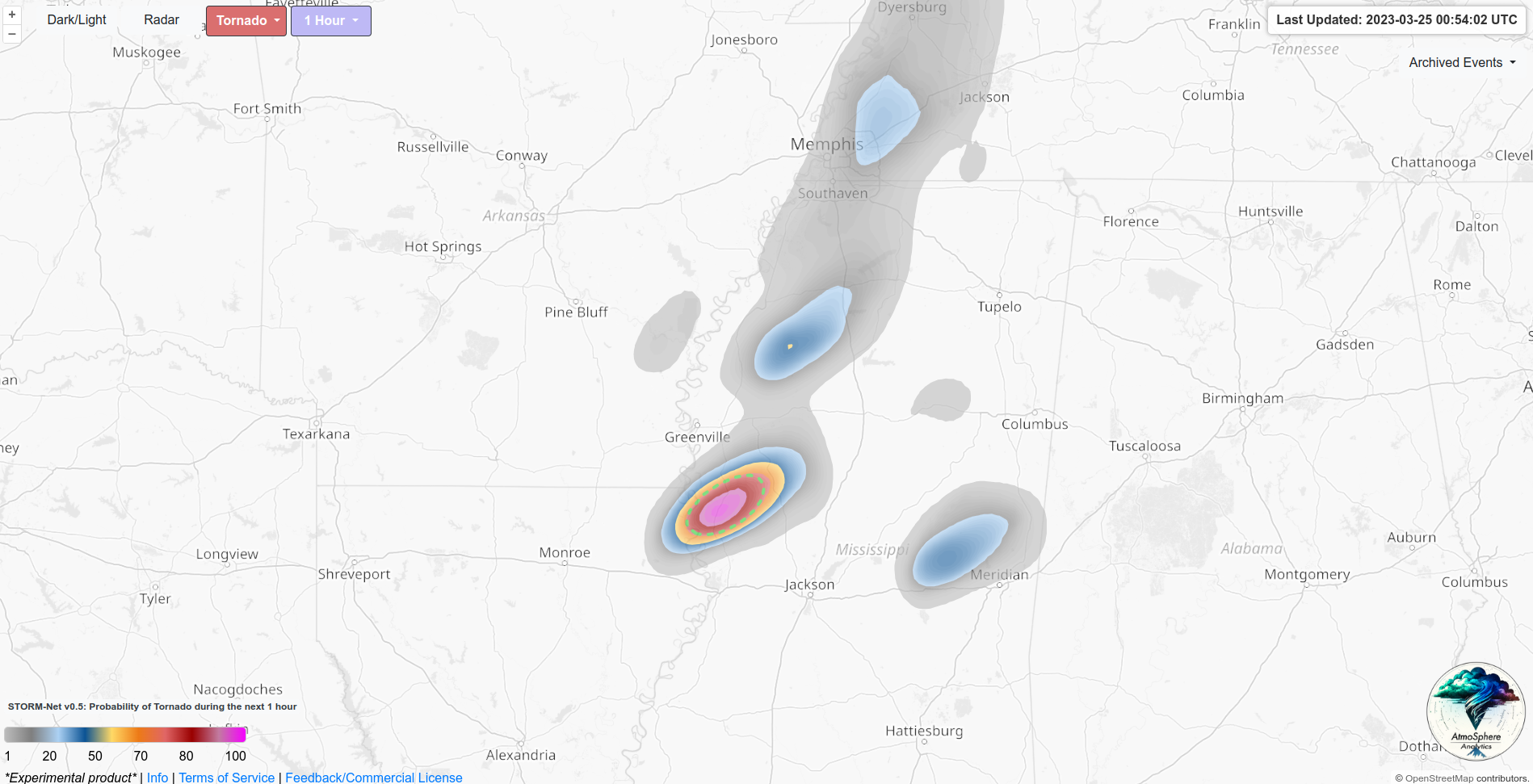
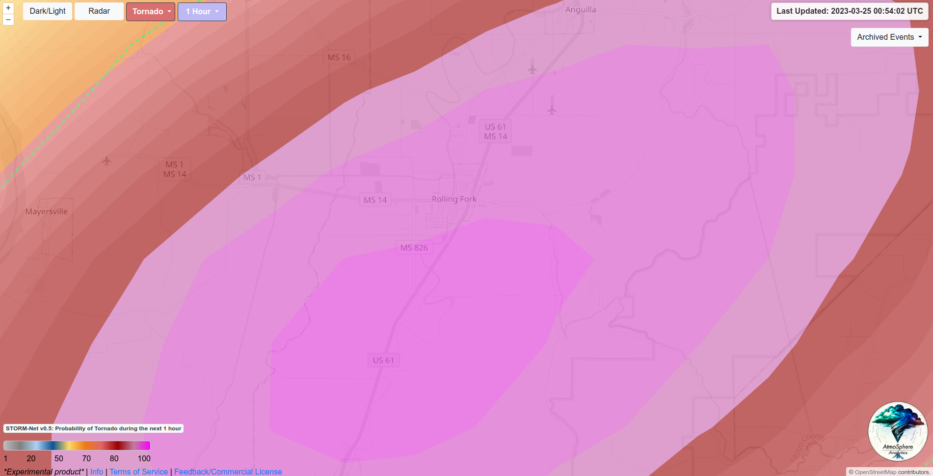
STORM-Net was highlighting the Rolling Fork area as early as 00:38 with very high tornado probabilities and sig-tor probabilities; 16 minutes prior to the tornado warning, and 30 minutes prior to Rolling Fork's impact. This was before that storm was even exhibiting rotation or supercellular characteristics! STORM-Net remained consistent over the following runs. Below are the STORM-Net forecasts from 00:38, 00:44, 00:48, and 00:54.
00:38UTC (30 minute lead-time)
00:44UTC (25 minute lead-time)
00:48UTC (20 minute lead-time)
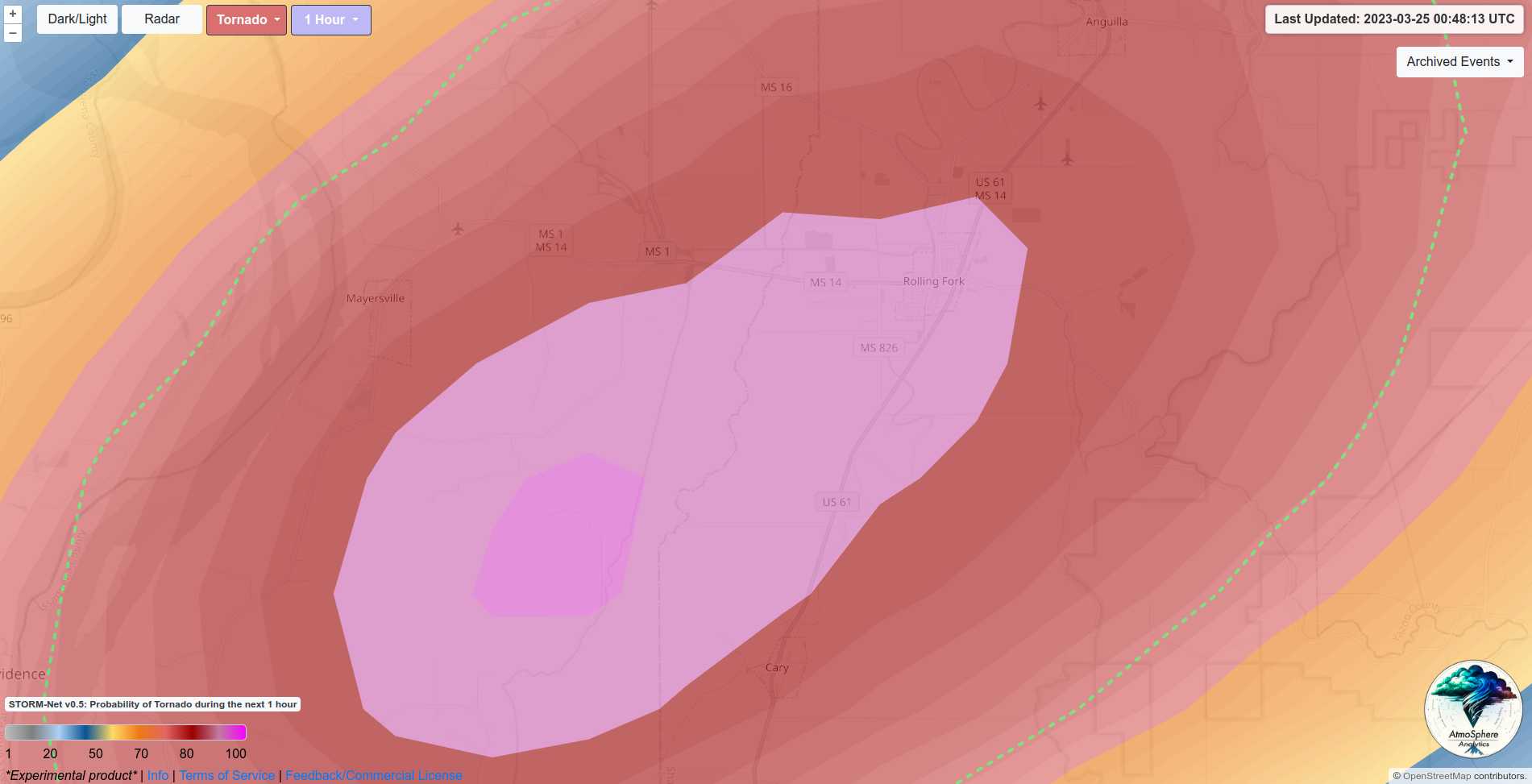
00:54UTC (14 minute lead-time)
Interested in implementing STORM-Net?
Contact us today for a free quote
